
Snowbank - Disappointment Lake Loop Run Report
- alexanderfalconer
- May 27, 2020
- 4 min read

On Saturday, May 23rd I set out to run the Snowbank - Disappointment Lake Loop. As my previous blog outline, I’ve switched up my planned runs for the year. Logistics of the era we find ourselves in didn’t allow for the Boundary Waters Traverse - the 110 mile route following the Border Route Trail and Kekekabic Trails. Instead I’m focusing on the 5 or 6 trail of 20+ miles and will run each of them this year. This is the first run in this series!
This route consists of three different trail segments - a Western portion of the Kekekabic Trail (“the Kek”), the Disappointment trail that connects the Kek to the Snowbank Lake Trail near the portage between Snowbank Lake and Boot Lake. The trail then meets up with Snowbank Lake Trail and winds around Snowbank Lake back to the trailhead to complete the loop.
I started out at 10 am. The parking lot at the trailhead was packed, so I decided to go counterclockwise with the assumption most day-hikers were headed north/clockwise to get views above Snowbank Lake. Whether that guess was reality or not, I did not encounter very many people during the first half of the route.
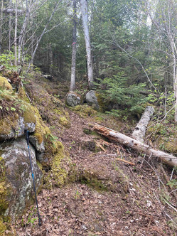
The Kek portion of the trail was the most runnable - it’s the most traveled and crews have been working hard the past few years to clear up trail from the 2016 blowdown storm. The trail goes south and then hooks east along the southern edge of Snowbank and crosses into the Wilderness border near Parent Lake. The trail is characterized by a constant up over the granite hills, through black spruce, red pine and some old white pine stands. 2 beaver dams on this section serve as bridges across lakes.


As the Kek continues east it passes the southern portion of Disappointment Lake and meets the Disappointment Trail - marked by as a sign post carved in a downed tree trunk. The Disappointment portion was the hardest trail section to follow - it’s the least traveled and most remote section of this loop. Several trees were down obscuring the trail. The map on my gps device didn’t correlate to reality and several times I found myself more or less bushwhacking through some brush and thick forest to keep going in the correct direction until the trail was more established once again. I’m not sure if I turned and missed something, I had to stop and retrace my steps a few times, but I was able to find my way again at least!
The trail winds along the edge and bays of Disappointment Lake which is a very irregular shaped long and winding lake. I didn’t see much wildlife of note (except for probably a thousand ticks I was constantly picking off my shoes, socks and legs!!), however there was a lot of fresh moose and bear scat indicating a few of them had been through that night or morning!
At Boot Lake, the Disappointment Trail meets with the Snowbank Lake trail which was easier to navigate once more. This was also a great spot to refill my water.

There’s a strong river flowing out of Snowbank into Boot Lake where I stopped and rested for a bit, talked to Don from Duluth who unfortunately lost his favorite set of pink crocs and asked that I keep an eye out for them - unfortunately I did not see them! I would assume that no medical professional would ever recommend not filtering water, but I rarely ever do in the Wilderness. The water is still so pure and if I can find a strong enough river flowing out of a big lake I’m reasonably sure it’ll be safe to drink! This is of course one of the primary reasons we need to stop sulfide-ore mining from being placed in this watershed. These waters are some of the cleanest and most pure left on earth - so clean you can drink straight from the lakes!
Leaving the Boot Lake portage, the trail climbs to its highest points north of Snowbank Lake offering sweeping views of the lake and its many islands.

I was greeted by a few bald eagles riding the thermal currents over the lake, a wonderful breeze cooling my face (and chasing away gnats and mosquitos), and at this point several more hikers out on their back country hiking-camping trips.
The trail along the north of the lake was relatively hard to follow as it went over exposed granite vs. the forest of the rest of the trail.


There were rock cairns to follow and some intuition of “yeah, this looks kinda like where I should go” and I found my way well enough. It winds back down off the “summit” and again over several beaver dams - one precariously thin - back into the forest (and ticks!). The trail heads south along the western side of the Lake on a heavily traveled and easy to follow trail. At one point I found myself on a forest service road - I think that’s on purpose, or maybe I missed a turn again, but eventually wound my way back to the trail head.
I was greeted by Erica and our kiddos cheering my return almost exactly 7 hours after I left!
This was the first submission for this loop on the FKT site, so I’ve established the route and the first attempt and registered the the current fastest known time! That link also has the gpx file if you'd like to download and use for yourself. I also marked several areas where the trail needs some attention - downed trees mostly - that I've shared with the Forest Service and trail associations for their info.

If you've read this long - 1) thanks! but 2) we need to do everything we can to protect this Wilderness from sulfide-ore copper mining proposals in its watershed. Please go to my Take Action page and sign the petition. You can also call your Representative directly and ask that she or he sign on to Representative McCollum's bill: HR5598 which would permanently ban this sort of mining in this watershed. Call 202-224-3121 and follow the prompts to be connected to your Representative's office today!


Comments